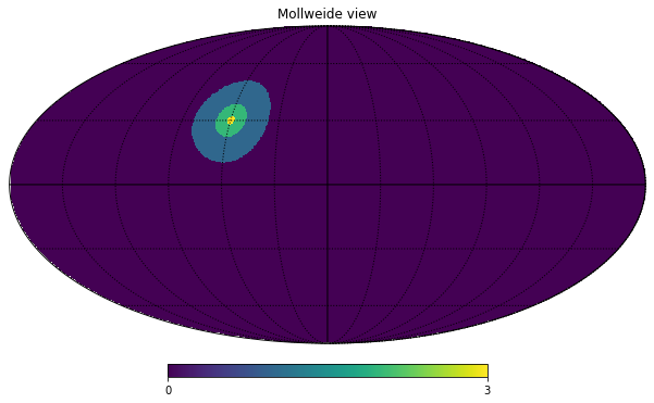
import healpy as hp
import numpy as np
lonlat=True switches ang2vec from requiring colatitude \(\theta\) and longitude \(\phi\) in radians to longitude and latitude in degrees (notice that also the order changes)
# in degrees
lon = 60
lat = 30
vec = hp.ang2vec(lon, lat, lonlat=True)
nside = 256
large_disc = hp.query_disc(nside, vec, radius=np.radians(20))
small_disc = hp.query_disc(nside, vec, radius=np.radians(8))
tiny_disc = hp.query_disc(nside, vec, radius=np.radians(2))query_disc returns a list of pixels, by default in RING ordering, let’s check their length:
list(map(len, [large_disc, small_disc, tiny_disc]))[23715, 3829, 237]Create a map and plot it in Mollweide projection
m = np.zeros(hp.nside2npix(nside))m[large_disc] = 1
m[small_disc] = 2
m[tiny_disc] = 3hp.mollview(m)
hp.graticule()0.0 180.0 -180.0 180.0
The interval between parallels is 30 deg -0.00'.
The interval between meridians is 30 deg -0.00'.